Lab. Members in 2012
Master's degree student
AITO, Fujita
| Title of my study | Resolution enhancement of irrigation database |
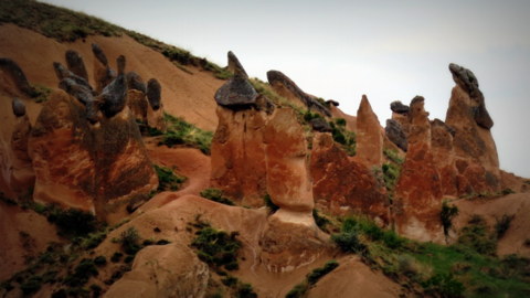
| Overview | Recently, the environmental variation, induced by climate changes and anthropogenic activities, has adversely affected the regional water resource, which is augmenting the worldwide concern about the sustainable water use and directing us to pay more heed toward it. When it comes to water use, we need to appropriately comprehend it in irrigated areas, and the technique of remote sensing is expected to be applicable to the estimation or the identification of the productivity or the land use in this irrigated regions. In particular, time-series satellite imagery, due to its wide coverage and high frequency, makes feasible the land use classification and crop monitoring, exploiting seasonal changes of crops, which have not been achieved ever. However, the spatial resolution of the existing time-series satellite imagery is so relatively coarse that several components of land cover type occur within a pixel, and that the result of conventional classification approaches tends to be erroneous because the internal structure within a pixel is NOT taken into account. In order to obtain the classification map with higher accuracy, it is desired that an approach is to be implemented by which a single class is not assigned to a pixel but multiple cover types are classified with the quantitative proportion with which each class occupies that pixel. In this study, the irrigation area located in the southeast of Turkey was selected as the study site where diverse land cover types including crops, orchard, urban, soils and other miscellaneous classes are mixed, and I'm working on developing the model which can estimate the fractions (proportions) of land cover types within pixels from time-series data acquired from time-series satellites including MODIS and SPOT/VEGETATION by employing the concept of Spectral Mixture Analysis by virtue of its analytical tractability and accepted accuracy. This model could be ubiquitously (anywhere/time, here) used to accurately estimate the land use information, which would lead to the enhancement of the resolution of the existing irrigation area maps or cropping calendars. |
| Message |
Place of birth: Kyoto Japan |
Takashi, Matsumoto
| Title of my study | |
| Overview | We are trying to analysis water resource sustainability of the Euphrates River in Turkey with hydrological model. We use H08 model as hydrological model, which can simulate anthropogenic water use. There are region where we can't get enough quality data to simulate with hydrological model. Therefore we use rough global data we can get at first. Thereafter we add more accurate data, and we improve our output. |
| Message |
|
ONO, Yumiko
| Title of my study | |
| Overview | Conventinal irrigated agriculture have been brought serious environmental problems such as drying up of groundwater, shrinking of lakes or salinization all over the world. Recently, "Integrated Water Resources Management" have gatered momentum in order to come up with these problems."Integrated Water Resources Management" is the way to balance the development of the society and economy and the conservation of the environment which include the concept "sustainable development". The purpose of this study is to make indicators of the sustainable water resources management. |
| Message |
|
NAKASHIMA, Kazunari
| Title of my study | Analysis of crop productivity in irrigated area using time-series satellite images |
| Overview | The stable production of food, as exponentialy worldwide population increases, is one of the most interesing problems in the world.Irrigated agriculture with high productivety is practiced around the world and contributes to increase in food production.Inappropriate management causes the depletion of water resource and salinization in the irrigated area and results in decrease in food production.The purpose of my research is to evaluate the productivety and pin down the problem in these area by analyzing irrigated agricultural area using time-series satellite images. |
| Message |
|
MIYASHIMA, Takashi
| Title of my study | |
| Overview | Currently, soil salinization due to inappropriate irrigation and drainage management is threatening agricultural productivity in arid and semi-arid region of the world. Salinization causes not only crop failure but also it leads to desertification. To counteract this problem, it is necessary to identify the area and degree of salinity by periodical monitoring. Presently direct detection of salinity by operating sensors on satellites seems to be difficult. The objective of my research is to develop methodology using the near-infrared hyperspectral spectroscopy to quantify salt content of soil, plant and water. If my research is successfully implemented and validated, the rapid and global monitoring of salinization by satellite can be realized in the near future, tar-geting the agricultural land all over the world. |
| Message | I ♥ Music! |
Undergraduate student
TAKEUCHI, Ryoko
| Title of my study | Examination of the repairing method which considered biodiversity of reservoir |
| Overview | The land consolidation is progressing in various places in recent years.
The productivity and environment of agriculture is improved by the project, but large-scale construction affects surrounding environment.
There are some ponds which cultivated land maintenance has not been carried out yet in the Nishitani area of Takarazuka City, Hyogo Prefecture.
|
| Message | I ♥ Akashi city! But I think it would be more lovely if the Loft store was available around Akashi station for real. |
YAMAMURA, Yuta
| Title of my study | Investigations of the relationship between salinization and shallow water table in a large irrigation district |
| Overview | In large irrigation area of an arid region, the productivity of crops are often reduced remarkably because of soil, water and crop salinization result from inefficient irrigation caused by lack of hydraulic structures and over irrigation. |
| Message | Prog rock is my life. |